Cream laid paper with watermarks. 19.9 x 14.3 cm.Bound with: al-Taʻarruf / lil-Kalābādhī.MS Arab 225. Houghton Library, Harvard University.In Ottoman Turkish and Persian.
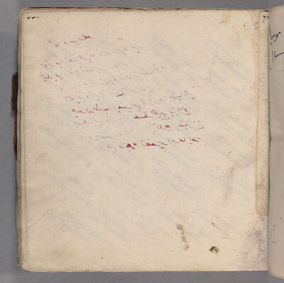
Title supplied by cataloger.Written in various hands, mostly in two columns, number of lines per page varies. Written in black rubricated in red. Comments in the margins.MS Turk 59. Houghton Library, Harvard University.In Ottoman Turkish.Electronic reproduction. Cambridge, Mass. : Harvard College Library Digital Imaging Group, 2008. (Open Collections Program at Harvard University. Islamic Heritage Project).
by Mounsieur Sanson ; rendred into English and illustrated by Richard Blome ; Francis Lamb Sculpit.Covers also portions of Spain, Sicily, Greece, Crete, Turkey and Cyprus.Relief shown pictorially.Includes ill. and index.In English, translated from French.
by Mounsieur Sanson ; rendred into English and illustrated by Richard Blome ; Francis Lamb Sculpit.Covers also portions of Spain, Sicily, Greece, Crete, Turkey and Cyprus.Relief shown pictorially.Includes ill. and index.In English, translated from French.
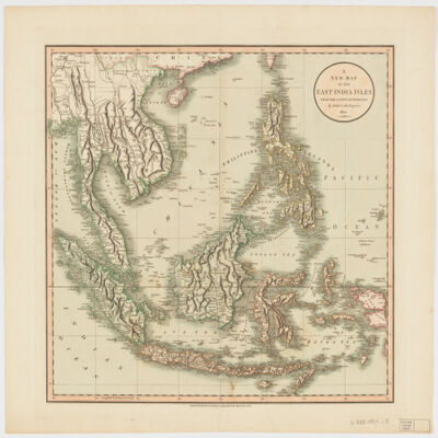
by John Cary.Relief shown pictorially and with shading.Prime meridian: Greenwich.Covers Sumatra, Java, Borneo, Sulawesi, the Philippines, Papua new Guinea and portions of China, Burma and Malaysia.Shows boundaries, rivers, roads and settlements.Electronic reproduction. Cambridge, Mass. : Harvard Geospatial Library, 2009. Georeferenced image for use in a GIS.Electronic reproduction. Cambridge, Mass. : Harvard College Library Digital Imaging Group, 2009. (Open Collections Program at Harvard University. Islamic Heritage Project). Copy digitized: Map Coll (Pusey) : MAP-LC G8000 1801 .C3.
Paper. 15.7 x 11.4 cm. (13.3 x 9.3 cm.).Bound with: Khulāṣat siyar Sayyid al-bashar / li-Muḥibb al-Dīn Aḥmad ibn ʻAbd Allāh al-Ṭabarī (ff. 1r-19r).MS Arab 362. Houghton Library, Harvard University.
This layer is a georeferenced raster image of the historic paper map entitled: Routen der wichtigsten und neuesten Reisen in Afrika. It was published by Ed. Hölzels geogr. Inst. in 1884. Scale [ca. 1:40,000,000]. The image inside the map neatline is georeferenced to the surface of the earth and fit to a non-standard 'World Sinusoidal' projection with the central meridian at 20 degrees east. All map collar and inset information is also available as part of the raster image, including any inset maps, profiles, statistical tables, directories, text, illustrations, index maps, legends, or other information associated with the principal map. This map shows features such as drainage, cities and other human settlements, expedition routes, and more. This layer is part of a selection of digitally scanned and georeferenced historic maps from the Harvard Map Collection and the Harvard University Library as part of the Open Collections Program at Harvard University project: Organizing Our World: Sponsored Exploration and Scientific Discovery in the Modern Age. Maps selected for the project correspond to various expeditions and represent a range of regions, originators, ground condition dates, scales, and purposes.Historic paper maps can provide an excellent view of the changes that have occurred in the cultural and physical landscape. The wide range of information provided on these maps make them useful in the study of historic geography, and urban and rural land use change. As this map has been georeferenced, it can be used in a GIS as a source or background layer in conjunction with other GIS data.None planned