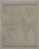
1. ‘New and Improved Map OF VARIOUS ROUTES BETWEEN EUROPE AND INDIA Comprehending WESTERN AND NORTHERN ASIA, TOGETHER WITH ASIA MINOR AND EGYPT BY J.B. TASSIN’ Contributor: Jean-Baptiste Athanase Tassin (publisher) Date: 1834/1834 Language: English Geographic region: AfricaAsiaEurope Extent: 1 map
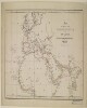
2. 'Map of routes from Europe to Upper India and Central Asia via Red Sea, the Euphrates Valley, and Kurrachee’ Date: 1845/1855 Language: English Geographic region: EuropeAfricaAsia Extent: 1 map sheet
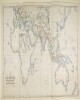
3. ‘MAP SHOWING THE STEAM COMMUNICATION AND OVERLAND ROUTES between ENGLAND, INDIA, CHINA & AUSTRALIA. Drawn & Engraved by J. Walker’ Contributor: William H Allen and Company, booksellers and publishers, London (publisher) Date: 1853/1853 Language: English Geographic region: EuropeAsiaAfricaAustralia Extent: 1 map
4. 'MAP NO.1: TURKEY IN EUROPE ZONE OF THE STRAITS SMYRNA THE ISLANDS' Date: 1919/1921 Language: English Geographic region: TurkeyEurope Extent: 1 map
5. ‘Sketch map reduced from Sir R.M. Stephenson’s Railway map of Europe and Asia in 1850 and of China in 1863 Shewing the Proposed Railway Communication Connecting Europe and Asia. By Sir Rowland Macdonald Stephenson. 1882’ Contributor: Sir Rowland Macdonald Stephenson (surveyor) Date: 1882/1882 Language: English Geographic region: EuropeAsia Extent: 1 map